List Of Districts in Gujarat 2023
List Of Districts in Gujarat 2023: The western Indian state Gujarat has 33 regions after a few parts of the first 17 locale at the development of the state in 1960. Kutch is the biggest area of Gujarat while Dang is the littlest. Ahmedabad is the most populated region while Dang is the least. There are 252 Talukas in Gujarat.
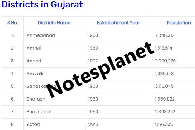
Districts in Gujarat
| S.No. | Districts Name | Establishment Year | Population |
| 1. | Ahmedabad | 1960 | 7,045,313 |
| 2. | Amreli | 1960 | 1,513,614 |
| 3. | Anand | 1997 | 2,090,276 |
| 4. | Aravalli | 2013 | 1,039,918 |
| 5. | Banaskantha | 1960 | 3,116,045 |
| 6. | Bharuch | 1960 | 1,550,822 |
| 7. | Bhavnagar | 1960 | 2,393,272 |
| 8. | Botad | 2013 | 656,005 |
| 9. | Chhota Udaipur | 2013 | 1,071,831 |
| 10. | Dahod | 1997 | 2,126,558 |
| 11. | Dang | 1960 | 226,769 |
| 12. | Devbhoomi Dwarka | 2013 | 752,484 |
| 13. | Gandhinagar | 1964 | 1,387,478 |
| 14. | Gir Somnath | 2013 | 1,217,477 |
| 15. | Jamnagar | 1960 | 1,407,635 |
| 16. | Junagadh | 1960 | 1,525,605 |
| 17. | Kutch-Bhuj | 1960 | 2,090,313 |
| 18. | Kheda-nadiad | 1998 | 12,053,769 |
| 19. | Mahisagar | 2013 | 994,624 |
| 20. | Mehsana | 1960 | 2,027,727 |
| 21. | Morbi | 2013 | 960,329 |
| 22. | Narmada | 1997 | 590,379 |
| 23. | Navsari | 1997 | 1,330,711 |
| 24. | Panchmahal | 1960 | 1,642,268 |
| 25. | Patan | 2000 | 1,342,746 |
| 26. | Porbandar | 1997 | 586,062 |
| 27. | Rajkot | 1960 | 3,015,229 |
| 28. | Sabarkantha | 1960 | 1,388,671 |
| 29. | Surat | 1960 | 6,079,231 |
| 30. | Surendranagar | 1964 | 1,585,268 |
| 31. | Tapi-vyara | 2007 | 806,489 |
| 32. | Vadodara | 1960 | 3,093,795 |
| 33. | Valsad | 1966 | 1,703,068 |
Some Details About Gujarat
All out area of Gujarat is 1,96,244 km² including 1,88,838.60 km² rural region and 7,405.40 km² metropolitan region. According to 2011 details, Gujarat has a populace of 6,04,39,692 people groups, out of which metropolitan populace is 2,57,45,083 while rural populace is 3,46,94,609. There are around 1,22,48,428 houses in the state, including 54,74,870 metropolitan houses and 67,73,558 rural houses.
Name Of 33 District in Gujarat
| क्रमांक | जिलों के नाम |
| 1. | अहमदाबाद जिला |
| 2. | अमरेली जिला |
| 3. | आणंद जिला |
| 4. | अरावली जिला |
| 5. | बनासकांठा जिला |
| 6. | भरूच जिला |
| 7. | भावनगर जिला |
| 8. | बोटाड जिला |
| 9. | छोटा उदयपुर जिला |
| 10. | दाहोद जिला |
| 11. | डांग जिला |
| 12. | देवभूमि द्वारका जिला |
| 13. | गांधीनगर जिला |
| 14. | गिर सोमनाथ जिला |
| 15. | जामनगर जिला |
| 16. | जूनागढ़ जिला |
| 17. | कच्छ-भुज जिला |
| 18. | खेडा-नाडियाड जिला |
| 19. | माहीसागर जिला |
| 20. | मेहसाणा जिला |
| 21. | मोरबी जिला |
| 22. | नर्मदा जिला |
| 23. | नवसारी जिला |
| 24. | पंचमहल जिला |
| 25. | पाटण जिला |
| 26. | पोरबन्दर जिला |
| 27. | राजकोट जिला |
| 28. | साबरकांठा जिला |
| 29. | सूरत जिला |
| 30. | सुरेन्द्रनगर जिला |
| 31. | तापी-व्यारा जिला |
| 32. | वलसाड जिला |
| 33. | वडोदरा जिला |
Important Links
Facebook: Notesplanet
Instagram: Notesplanet1
Tags: Districts in Gujarat pdf, how many districts in Gujarat, Gujarat district map, east Gujarat district list, north Gujarat district list, Madhya Gujarat district list, top 10 largest district in Gujarat by area, Gujarat map.


